
NASA, IBM Launch AI Foundation Model for Lunar Science
NASA and IBM Research have launched an open-source AI model designed to help scientists analyze the Moon’s surface. The NASA-IBM Lunar Foundation Model was trained primarily on data from NASA’s Lunar Reconnaissance Orbiter (LRO) and can be adapted to tasks including crater mapping, volcanic-feature detection, and estimating the stability of ice near the lunar poles. as reported by Science Nasa The model is publicly available through Hugging Face, while its complete codebase is hosted on GitHub. NASA and its collaborators have also released machine learning-ready datasets and benchmark collections intended to support reproducible research and further experimentation.
A general-purpose model for lunar data
The model is a foundation model, meaning it was pre-trained on a large collection of mostly unlabeled data rather than built for a single task. That broad pre-training allows researchers to fine-tune it for specialized applications with relatively small amounts of labeled data.
This approach differs from traditional machine-learning workflows, in which scientists often build and train a separate algorithm for each task. A pre-trained foundation model can instead serve as a flexible starting point for multiple types of analysis.
For lunar research, that flexibility is particularly useful because NASA has accumulated a vast record of observations. LRO has collected data over the past 17 years, covering most of the Moon’s surface in detail. Its output is larger than the data from all other NASA planetary missions combined, creating an almost seamless, high-resolution mosaic of the lunar surface. The developer tools story also surfaces in Anthropic Launches Opus 5 With Fewer..., adding another angle.
NASA and IBM trained the model on roughly 2 million image tiles. The training collection included more than 1 million high-resolution camera images at 1-meter resolution and nearly 964,000 multispectral images at 100-meter resolution. The researchers also incorporated high-resolution imagery and terrain data from NASA’s GRAIL mission, Lunar Prospector, and JAXA’s Selenological and Engineering Explorer.
“NASA has spent decades building an extraordinary scientific record of the Moon, but collecting data is only part of the job,” Kevin Murphy, NASA’s chief science data officer and acting chief data and AI officer, said in the agency’s announcement. “We also have to make data easier for scientists to explore and use.”
From craters to polar ice
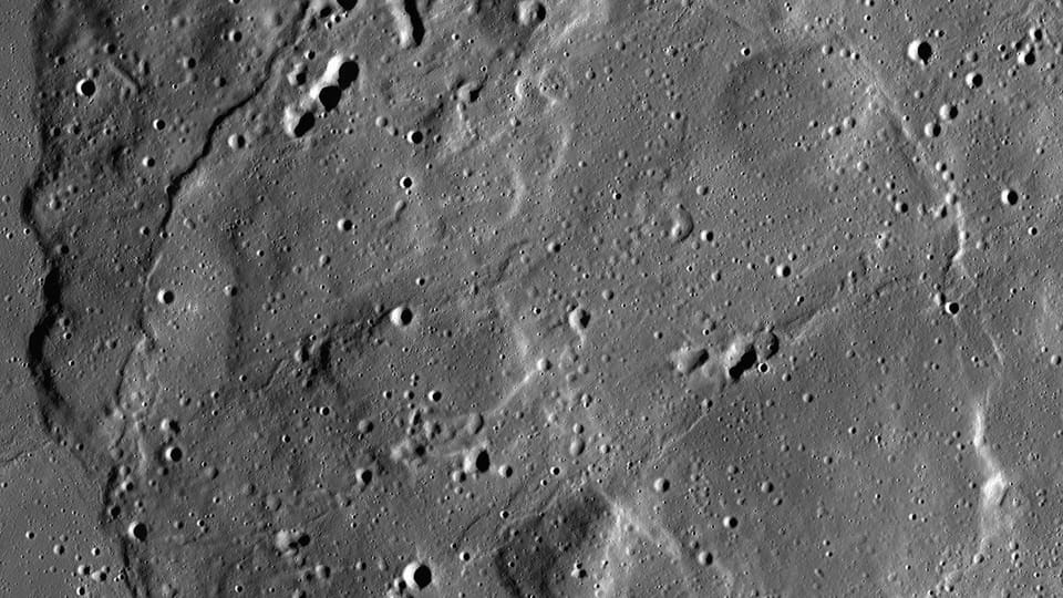
One of the model’s potential uses is mapping craters. Since each crater is created by an impact, crater counts and measurements help researchers estimate the age of lunar surfaces and reconstruct parts of solar system history. Automating the identification and measurement of craters could allow scientists to spend more time interpreting those results.
The model can also help identify irregular mare patches, unusual volcanic features that appear relatively young. Although the Moon is thought to be no longer volcanically active, it experienced significant volcanic and geological activity in the past. These apparently young formations challenge established timelines for lunar cooling. Mapping them could help researchers refine their understanding of the Moon’s thermal evolution.
Another application involves the search for lunar ice. Permanently shadowed regions near the poles receive little or no sunlight and remain cold enough to trap and preserve ice for potentially billions of years. The model can help estimate where ice patches may be stable, both on the surface and below it. The same ai search question is explored in Xiaomi-TabLDM, which adds a research perspective.
Those estimates have scientific value because polar ice could provide clues about the Moon’s history. They may also help researchers map resources that could be relevant to future exploration, although the model’s role is to estimate ice prospectivity rather than directly confirm the presence of ice.
Testing performance and surface changes
NASA and IBM evaluated the model against several strong baseline models across the lunar tasks described in the announcement. The NASA-IBM model achieved comparable results for crater mapping and segmentation of irregular mare patches, while showing a clear advantage in estimating polar ice stability.
The researchers also tested whether the model could help identify new changes between observations. In one example, LRO images near Einstein crater showed the lunar surface before and after a SpaceX rocket body impact. The post-impact image was excluded from the model’s pre-training, and the model was fine-tuned to detect the newly formed crater as well as existing craters.
That experiment suggests a possible method for automatically finding natural impacts and other surface changes across large lunar datasets. The source material notes that differences in lighting between orbital passes can affect the visibility of smaller craters, so image conditions remain an important consideration when interpreting results.
The model is integrated into TerraTorch, an open-source toolkit, and is accompanied by a research paper available through Hugging Face. By releasing the model, code, datasets, and benchmarks together, the teams aim to give researchers worldwide the ability to reproduce the work, compare approaches, and refine the system for future lunar studies. The developer tools story also surfaces in Google Research Unveils SensorFM Foundation Model..., adding another angle.
Part of a wider NASA-IBM effort
The Lunar Foundation Model is part of NASA’s broader AI-for-science strategy and an ongoing collaboration between NASA and IBM aimed at applying advanced AI to Earth and space science.
The partnership also includes the Prithvi family of models, which are trained on Earth-observation data for applications such as disaster monitoring, flood mapping, crop-yield prediction, and hurricane prediction. Another model, Surya, was trained on high-resolution solar observations to predict space-weather phenomena such as solar flares, which can disrupt power grids and satellite operations.
NASA’s Impact AI team at Marshall Space Flight Center worked with scientists from the agency’s Planetary Science Division, Goddard Space Flight Center, and Ames Research Center to build the lunar model. The wider science team included researchers from the Universities Space Research Association, the SETI Institute, the University of Maryland, Baltimore County, Howard University, and NASA.
The immediate significance of the release is not a single automated lunar map, but a shared foundation researchers can adapt to many problems. As new observations and labeled examples become available, scientists can test how well the model transfers across regions, imaging conditions, and scientific questions. That open experimentation will help determine where AI can most reliably accelerate lunar discovery.